Binpur-II is a Community Development Block that forms an Administrative Division in Jhargram Sub-Division of Jhargram District in the Indian State of West Bengal.
Geography:
The Chota Nagpur Plateau gradually slopes down creating an undulating area with infertile laterite rocks/ soil. In Binpur-II Community Development Block, 95% of the cultivated area has lateritic soil and 5% has alluvial soil. Binpur II CD Block is drought prone with a particularly severe drought situation.
Belpahari is located at 22°38'03.2"N 86°45'38.4"E.
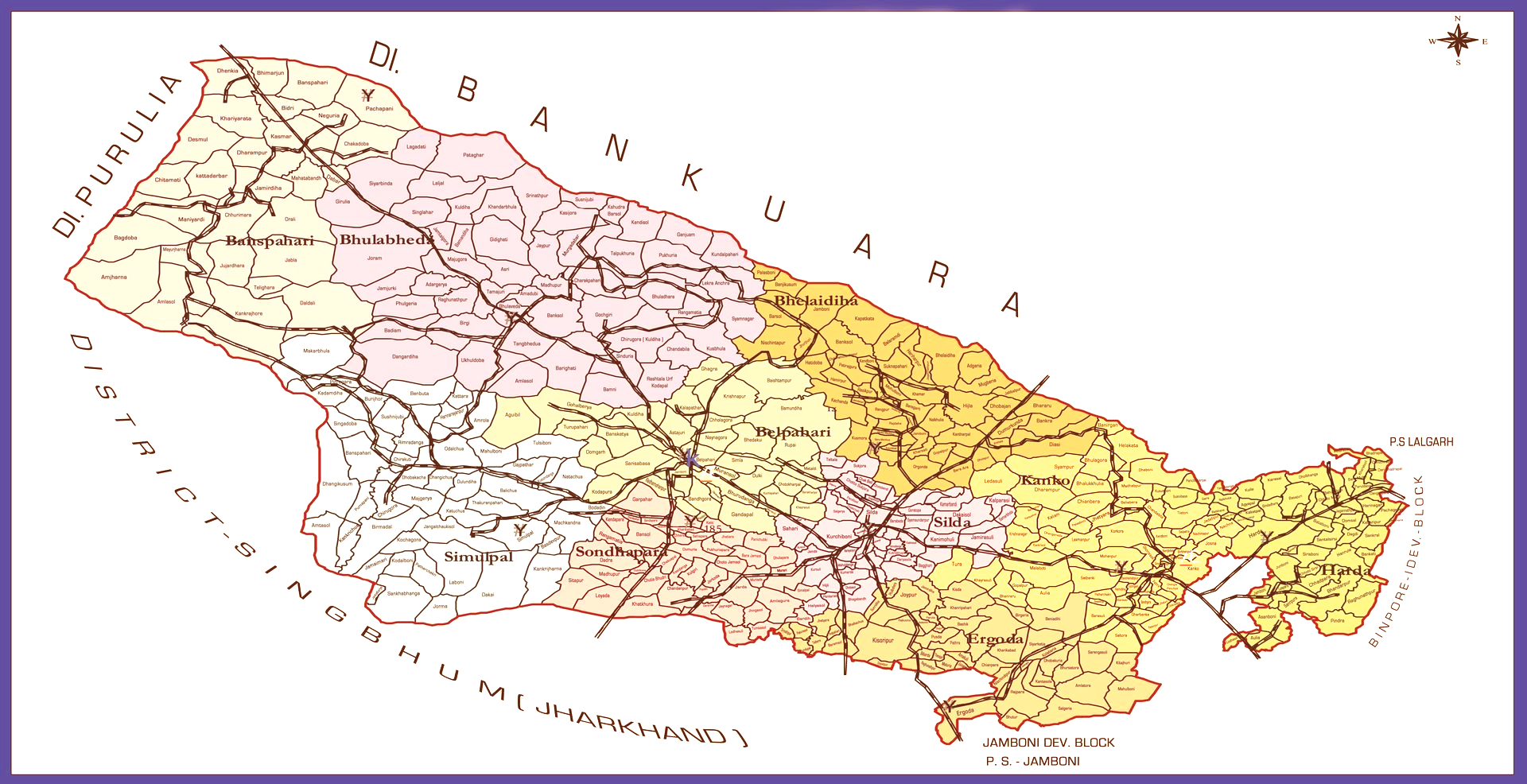
Binpur-II CD Block is bounded by Raipur and Ranibandh CD Blocks in Bankura District of West Bengal State in the North,
Binpur-I CD Block in Jhargram District of West Bengal State in the East,
Jamboni CD block in Jhargram District of West Bengal State and Ghatshila CD block in Purvi Singhbum District of Jharkhand State in the South and
Bandwan CD block in Purulia district of West Bengal State in the West.
It is located 40 km away from Jhargram, the District headquarters.
Binpur-II CD Block has an area of 600.22 Sqkm (231.75 sq mi). It has 01 Panchayat Samity, 10 Gram Panchayats (Banspahari, Belpahari, Bhelaidiha, Bhulaveda, Ergoda, Harda, Kanko, Sandapara, Shilda & Shimulpal), 128 Gram Sansads (village councils), 469 Mouzas out of which 401 inhabited villages, 67 uninhabited villages & 01 Town (Silda CT). Belpahari PS (including Banspahari Out Post) serving 06 Gram Panchayats (Banspahari, Belpahari, Bhelaidiha, Bhulaveda, Sandapara & Shimulpal) and Binpur PS serving 04 Gram Panchayats (Ergoda, Harda, Kanko & Shilda) in this CD Block under Jhargram Police District. Headquarters of this CD Block is situated at Belpahari.
Binpur-II CD Block had a Forest cover of 13,694 hectares, against a total geographical area of 60,022 hectares.
Demographics:
Population
According to the 2011 Census of India, Binpur-II CD Block had a total Population of 1,64,522, of which 1,58,798 were Rural and 5,724 were Urban. There were 82,654 (50%) Males and 81,868 (50%) Females. Population in the age range 0–6 years was 19,354. Scheduled Castes numbered 25,947 (15.77%) and Scheduled Tribes numbered 65,722 (39.95%).
Literacy
According to the 2011 census the total number of Literate persons in Binpur-II CD Block was 102,285 (70.46% of the population over 6 years) out of which Males numbered 58,804 (80.79% of the male population over 6 years) and Females numbered 43,481 (60.07% of the female population over 6 years). The Gender gap in Literacy rates was 20.72%.
Language and religion
In the 2011 census Hindus numbered 121,224 and formed 73.68% of the population in Binpur II CD block. Muslims numbered 1,220 and formed 0.74% of the population. Others numbered 42,078 and formed 25.58% of the population. Others include Addi Bassi, Marang Boro, Santal, Saranath, Sari Dharma, Sarna, Alchchi, Bidin, Sant, Saevdharm, Seran, Saran, Sarin, Kheria, Christians and other religious communities.
At the time of the 2011 census, 71.61% of the population spoke Bengali, 25.27% Santali and 2.71% Kurmali as their first language.